Pages

Showing posts with label Hiking. Show all posts

15/04/2023

Skye Trail


Interest in Scottish trails was re-ignited whilst hiking the WHW over the 18/19 New Year. Living on Dartmoor it is often easier to jump on a ferry and drive to the Alps or Pyrenees than it is to get to Scottish mountains, but we were enthused enough for a second long drive north. I had only been on Skye twice before, once to traverse the Cuillin Ridge with an old mate and a wander from Elgol with my wife to climb Blaven and camp in Camasunary bay which we had to abandon after a couple of days in a blizzard. However from this limited knowledge and looking at the map we decided to hike South to North figuring if nothing else a camp at Rubha Hunish would be a more fitting end than CO-OP carpark in Broadford.

Day 1

Looking down to Boreraig

Loch Slapin

Camasunary Bay

Old Camasunary Bothy

Day 2
Camasunary river crossing

Old Camasunary Bothy and Bla Bheinn

Heading to Coruisk

Bad step

Sheltering on the side of Sgur na Stri

Glen Sligachan

Glen Sligachan

Day 3
Sgurr nan Gillean and Am Basteir

Loch Sligachan

Loch Sligachan

Balmeanach

Loch Portree

Portree campsite

Day 4
Looking back to Portree from A'Chorra-Beinn

Trotternish Ridge

Trotternish Ridge

Trotternish Ridge

Trotternish Ridge

Trotternish Ridge

Beinn Edra Trotternish Ridge

Day 5
Trotternish Ridge

Quiraing

Quiraing

Flodigarry

Rubha Hunish

Rubha Hunish

12/01/2017

Pic Perdiguere

The dark of a January evening in front of the fire surrounded by a soggy Dartmoor it is easy for my mind to wander back to recent mountain adventures in warm sunshine. This is one such episode that will live long in my memory as a grand day (or so) out.

Lac d'Oo
Starting out from the Granges d'Astau an easy path (GR10) leads quickly up to Lac d'Oo and the Auberge. Continuing further up the valley we reach Lac d'Espingo and its accompanying refuge. At this stage the GR10 has turned off for Bagneres-de-Luchon and if you started late the crowds will have thinned.

Lac Saussat and Lac d'Espingo
After the third piece of water, Lac Saussat, the path starts to climb through the Cirque d'Espingo in order to reach Portillon where the fun begins.

Cirque d'Espingo
Refuge du Portillon is in a stunning position on the HRP and surrounded by numerous 3000m peaks.

Refuge du Portillon
It took us about 4.5 hrs and 1400+m to reach the refuge where we enjoyed a cold drink with our picnic lunch sat in the warm sunshine overlooking Lac du Portillon. Rested we now cross the dam and set off up to Collado Inferior de Lliterola, another 500+m at 2964m.

Approaching Collado Inferior de Lliterola
The col marks the start of our real objective to gain the ridge up to Punta de Lliterola 3116m, Pico Royo 3103m and Tuca de Lliterola 3080m. Initially the snow can be quite steep although this can be preferable to the broken loose ground lying underneath! but gaining the crest reveals good rock and plenty of opportunities for scrambling.

Gaining the Crest
and........
Approaching Punta de Lliterola
and........
Pico Royo with Pico Perdiguero behind left
The ridge is followed easily down to Collado Superior de Lliterola. An initial fairly steep scramble establishes you on Perdiguero (or as it is affectionately known to my wife "Jenga Mountain" due to the generally loose nature of most of the blocks on the North face), so exposed crest or loose blocks, neither are that bad.

After the initial scramble Pico Perdiguero
and........

Pico Perdiguro summit view
and........

Portillon far below
The route is now reversed to regain the col to head directly back to Portillon, firstly on a large fairly steep snowfield, followed by boulder fields festooned with occasionally useful cairns. As the way opens up in a more northerly direction a path becomes more evident which eventually rejoins our earlier path to the Col Inferior.

Collada Superior de Lliterola crampon moment
Reaching the Refuge at 7pm meant they were going to be busy with their guests so we passed without a celebratory beer and continued a little further to a bivy spot for the night.(2200+m positive/850+m negative)

Looking back from Portillon at 7pm
Lots of hot coffee and sandwiches for supper we watched the stars on and off through the night before the 4hr stagger out the following morning.

Comfy Pyrenees bivy


14/11/2016

Via-Alpina 2017

Another end to end hike.


We have always wanted to visit the Alps but never really decided where as there does seem to be quite a lot of them. Cicerone's "Trekking in the Alps" alone lists "20 classic routes" all competing for our attention, but there is nothing quite like starting at the sea and ending at the sea as the Pyrenean Haute Route does. So in what seems like a good idea in front of the fire on a cold Dartmoor evening tickets to Trieste are booked and we begin pouring over maps and kit lists in excited anticipation.

So its coming to the end of April, much planning, route worrying and kit selecting has been going on, most of which is totally unnecessary but still an integral part of preparing for one of our hikes. To make it "official" we announced to the world, or at least the Via Alpina Facebook page that we would be starting in June.........


Hi, we are Nick and Jo Mandeville. We live and work in the Dartmoor National Park in Devon UK. This year we start walking the Via-Alpina from Trieste on the 24th of June hoping to reach Monaco in early October. We have hiked, climbed, camped and bivouacked throughout Dartmoor, Snowdonia, Cumbria, Scotland and the Pyrenees. At a time of great change politically and environmentally we hope to discover an Alps that is inclusive and that inspires particularly the young who once captivated by mountains and wild places are sure to be their future guardians. If you see us stumbling along the trail please come and say Hi.


We aim to follow the "Red Trail" from Trieste as far as its intersection with the "Green Trail" (Alpine Pass Route) which we aim to take through Switzerland before meeting up with the "Tour Du Mont Blanc". At some point on the "TMB" we will break off to join the "GR5" which will form the basis of our route down to Monaco. 
Along the way if the weather is kind, we have the time and a little extra in our legs we will try and summit Triglav, Buet and Viso.............its a rough plan anyway!


Via Alpina Kit.
So that is it we are off, if you would like to catch up and see what happens next look us up on Instagram.

We made it!!!!!.................

On the morning of Monday 25 September, day 94, we hiked the final one and a half hours from our last bivy to the beach at Menton bringing to an end a great adventure. Discovering Slovenia, Italy, Austria, Germany, Lichtenstein, Switzerland and France. Bears, Wolves, Boars, Squirrels, great birds of prey, salamanders, snakes and the most wonderful flowers. Sunshine to nearly 40c, blizzards and high bivys down to -10c.
Lots of pain and huge amounts of pleasure, we reveled in glorious landscapes and met some amazing people.................just for now we will let it sink in!

Read the full story here

31/08/2016

Hiking "La Porta del Cel" in the Pyrenees

Last year during our second traverse of the Pyrenees we had intended to include an ascent of Pic d'Estats, however the weather had other ideas and it was whilst sheltering at Camping Bordes de Graus we learned of "La Porta del Cel" (Sky's Door). The route generally starts at Tavascan with a short walk to the Refuge at Bordes de Graus and continues clockwise via the Refuges of Certascan, Pinet and Vallferrera, taking in the Peaks of Certascan and d'Estats before returning to Tavascan. Whilst we were not interested in staying at the refuges and getting the T-shirt the route looked fun and whilst being roasted on a Mediterranean beach we were in need of mountains.
Not wanting to drive all the way around into Spain we decided to start in Ariege (l'Artigue) and pick up the route at Aiguamolls and continue anti-clockwise towards Certascan thus allowing ourselves a little time to find our feet before Pic d'Estats.

Cascades de l'Artigue

From the parking at l'Artigue we initially follow the path to Refuge Pinet but soon leave on a rising path along the North side of the Ruisseeau de l'Artigue. The path splits again on crossing the stream, the northerly route heading to Pic Rouge and ours continuing westerly into a hanging valley, where we join the main route, before finally reaching Port de l'Artiga (2477m) with clear views over to tomorrow mornings objective Pic de Certascan.

Pic de Certascan from Port de l'Artiga
A well marked path led us on down to Estany de Romedo de Baix and then back up to Estany Romedo de Dalt where we knew there were good camping spots. Pitch selected, a swim in the lake, supper and we were ready for sleep.

Estany de Romedo de Dalt

Much of today is familiar from our HRP crossing in 2013, a short climb to the col before a steep descent and traverse to Estany de Certascan and the Refuge.

Estany de Certascan

Under clear skies we climbed to the Coll de Certascan, no snowfield this year, dumped our packs and set off to climb Pic de Certascan. Great views and a small group of Bouquetin on the summit made the climb worthwhile.

Pic de Certascan with Bouquetin

All downhill from here, return to the col for a snack before starting the long descent to Noarre and on to Camping Bordes de Graus for much needed cold beer, followed by an equally required shower! Supper was as hearty, fun and tasty as usual, late and full we turned in.

Noarre

Whatever way you look at this route our third day would be the crux, having decided to stay at Bordes de Graus meant adding the short section down to Tavascan on to what would undoubtedly be a long day, and so it proved. In just over an hour of pleasant walking we were outside the only shop in Tavascan, we waited 10 mins before ringing the bell, after a shout from the balcony above it was another 10 mins before the door opened. Re supplied and fed in the warming sun we set off to climb out of the valley, from 1100m it would be 7hrs of up before reaching our high point of the day, Roca Cigeralera, at 2668m.

Leaving Tavascan

It was here that we met a shepherd with his flock, 3 collies and 2 mountain dogs. Having worked as a shepherd it was great to talk sheep and dogs in such an amazing position.

Pyrenean Mountain dog at Roca Cigalera

From here the route descends from Coll de la Llaguna across a fairly testing boulder field, up to coll de Sellente and down again to the unmanned Refugi de Baborte. At this point most trekkers would continue down to Refugi de Vallferrera but without the need to visit the refuge we continued rather sluggishly to Coll de Baborte intent on finding a bivy spot around the Estanys de la Coma de Sotllo.

Coll de Baborte from Coll de Sellente

It was very tired legs that searched out a flat spot that evening but we were in a prime position for tomorrow and so far the weather was still good.

Someone reluctant to leave their sleeping bag

Despite some reluctance in the camp we were away by 7am the following morning to descend to Estany de Sottlo to pick up the main route up Pica d'Estats, a steady climb and then steeply through scree up to Port de Sotllo and into France.

Port de Sotllo

The main path went way down to avoid a rock step and snow which were easily tackled without having to lose much height and from Coll de la Cometa we followed the direct line of ascent.

This way!

This felt like a proper mountain summit despite the crowds it was high, pointy and strangely remote feeling, all helped by the rather obvious change in the weather.

Pica d'Estats

All thoughts of Pic de Montcalm were dismissed and we set off  to see if we could beat the inevitable.
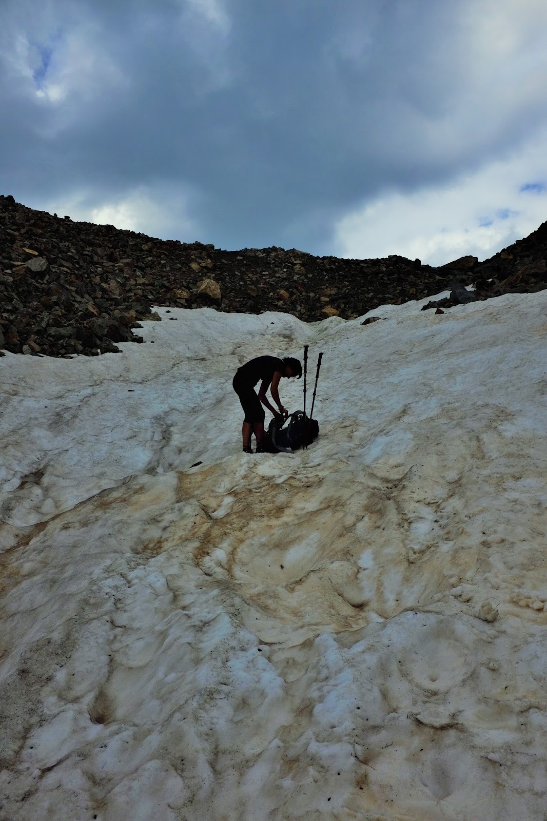
Storm clouds

Before we reached Etang d'Estats we were swallowed by cold wet mist reaching the Refuge Pinet in light rain and zero visibility. After a short stop for a drink we stepped out into heavier rain and rolling thunder which would accompany us all the way back to l'Artigue with bouts of heavy rain and hail for good measure but nothing could dampen our spirits following our 4 days on La Porta Del Cel.